
Sorry, your browser is not compatible with this application. Please use the latest version of Google Chrome, Mozilla Firefox, Microsoft Edge or Safari.
Integrated Modeling for Road Condition Prediction
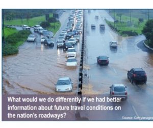
The IMRCP tool gathers historical, real-time, and forecast data from a variety of sensor systems and models. These data and models include atmospheric and road weather, hydrology, traffic, work zones, winter maintenance operations, incidents, special events, and demand models. The IMRCP system then combines all of this information in predicting road and travel conditions. The online IMRCP system includes an interactive map, notifications, and reports. Using controls within the map, users can view traffic, weather, and road condition predictions into the future, as well as analyze past events.
IMRCP can benefit transportation agency operations by complementing other tools that use similar data sets. As shown in this paper, IMRCP extends user awareness of traffic and road conditions into the future, beyond the capabilities of typical TMC tools and road weather information systems. IMRCP can share road weather data and forecasts with maintenance decision support systems (MDSS) while adding the traffic forecast perspective, but it does not provide direct winter maintenance guidance of an MDSS.
Interested in transportation? Check out this GovWhitePapers blog post! You can also find events on transportation on our sister site, GovEvents.


| Format: |
|
| Topics: | |
| Website: | Visit Publisher Website |
| Publisher: | Department of Transportation (DOT) |
| Published: | September 1, 2020 |
| License: | Public Domain |
Featured Content
Contact Publisher

Claim Content